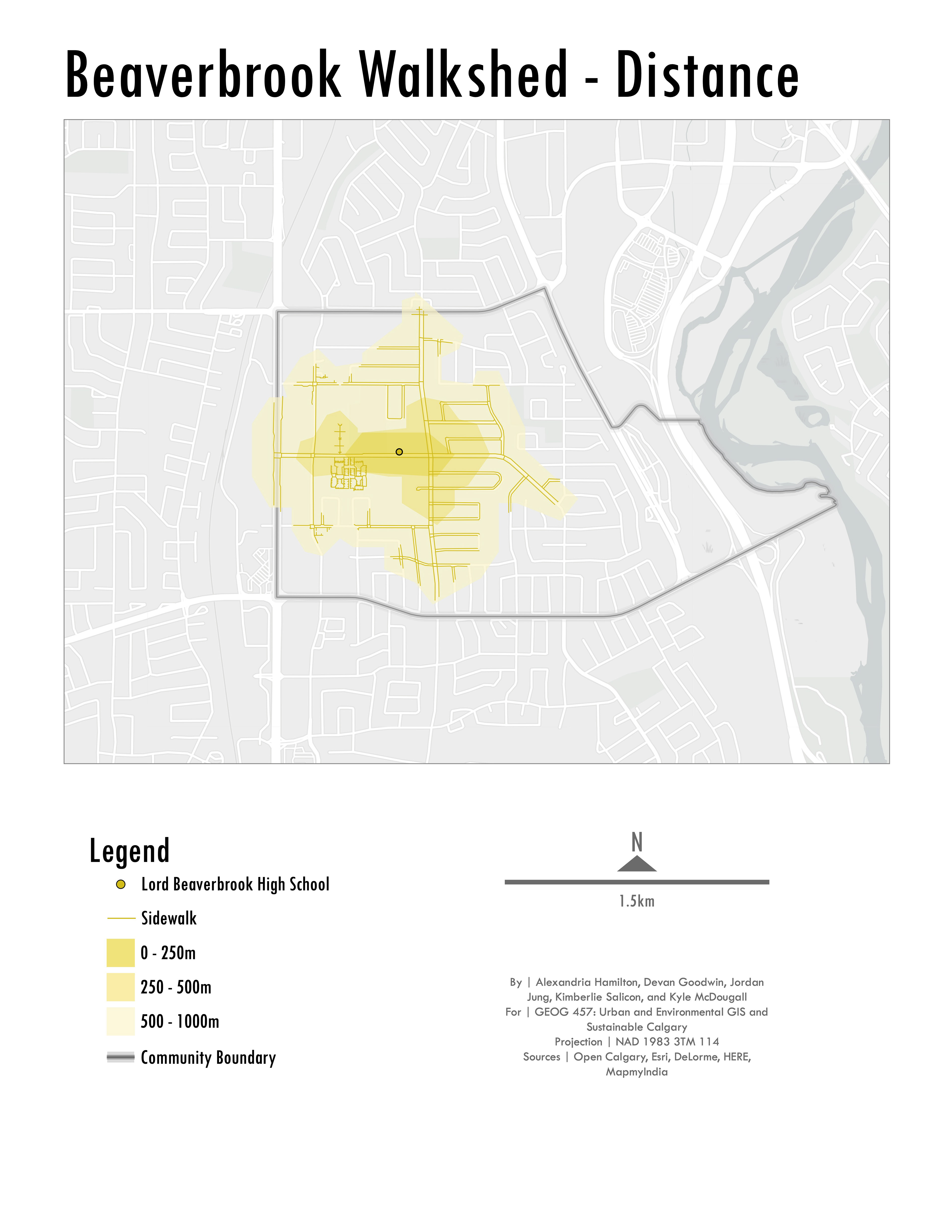
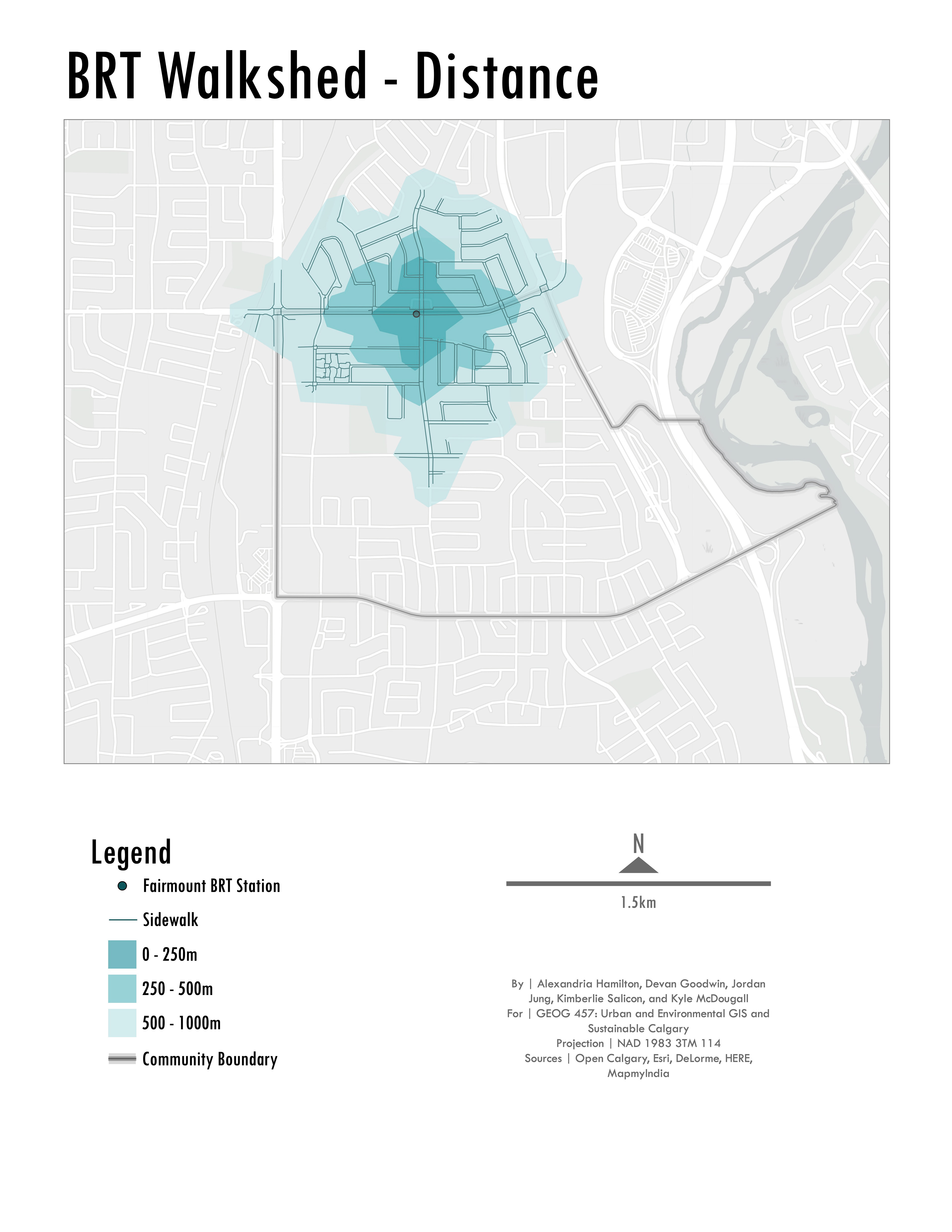
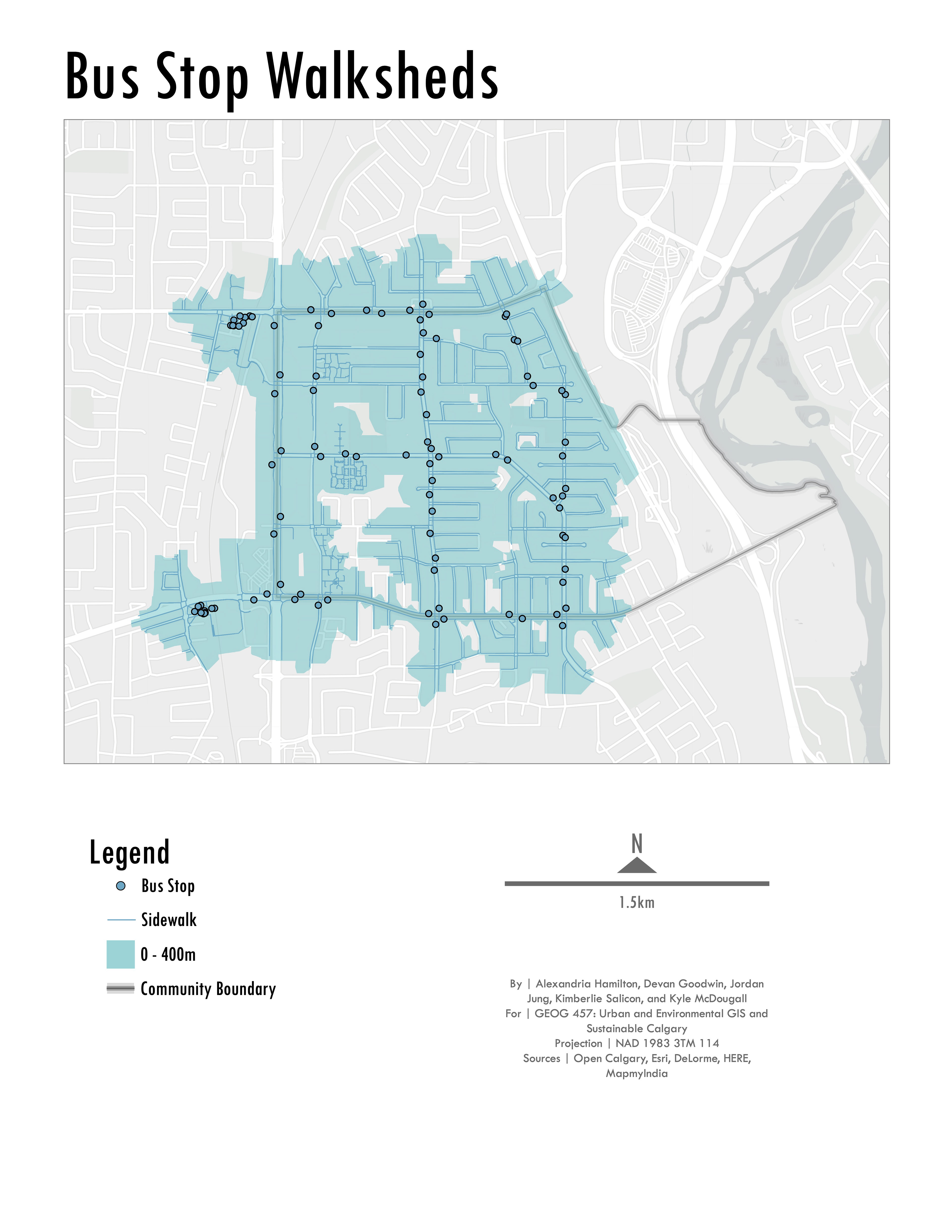
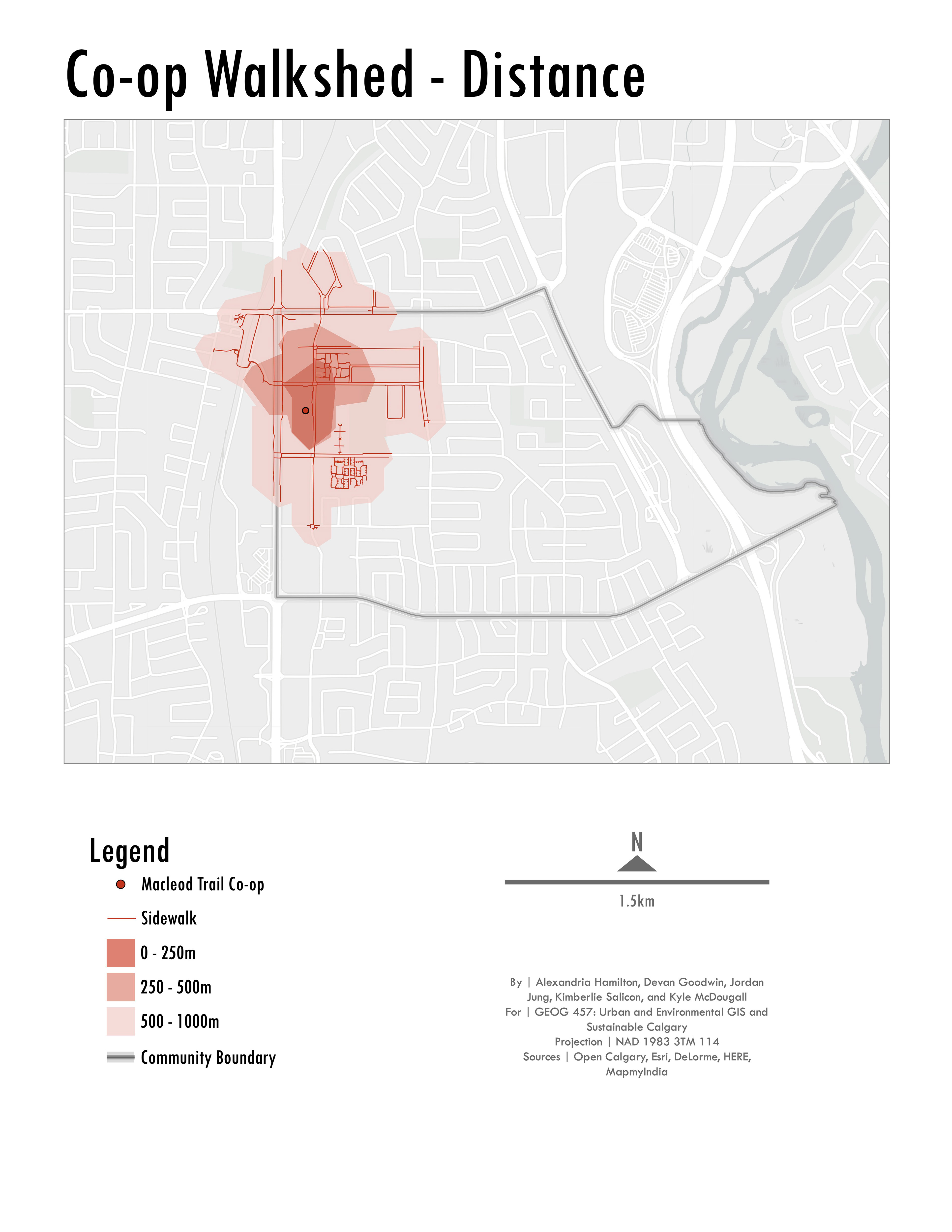
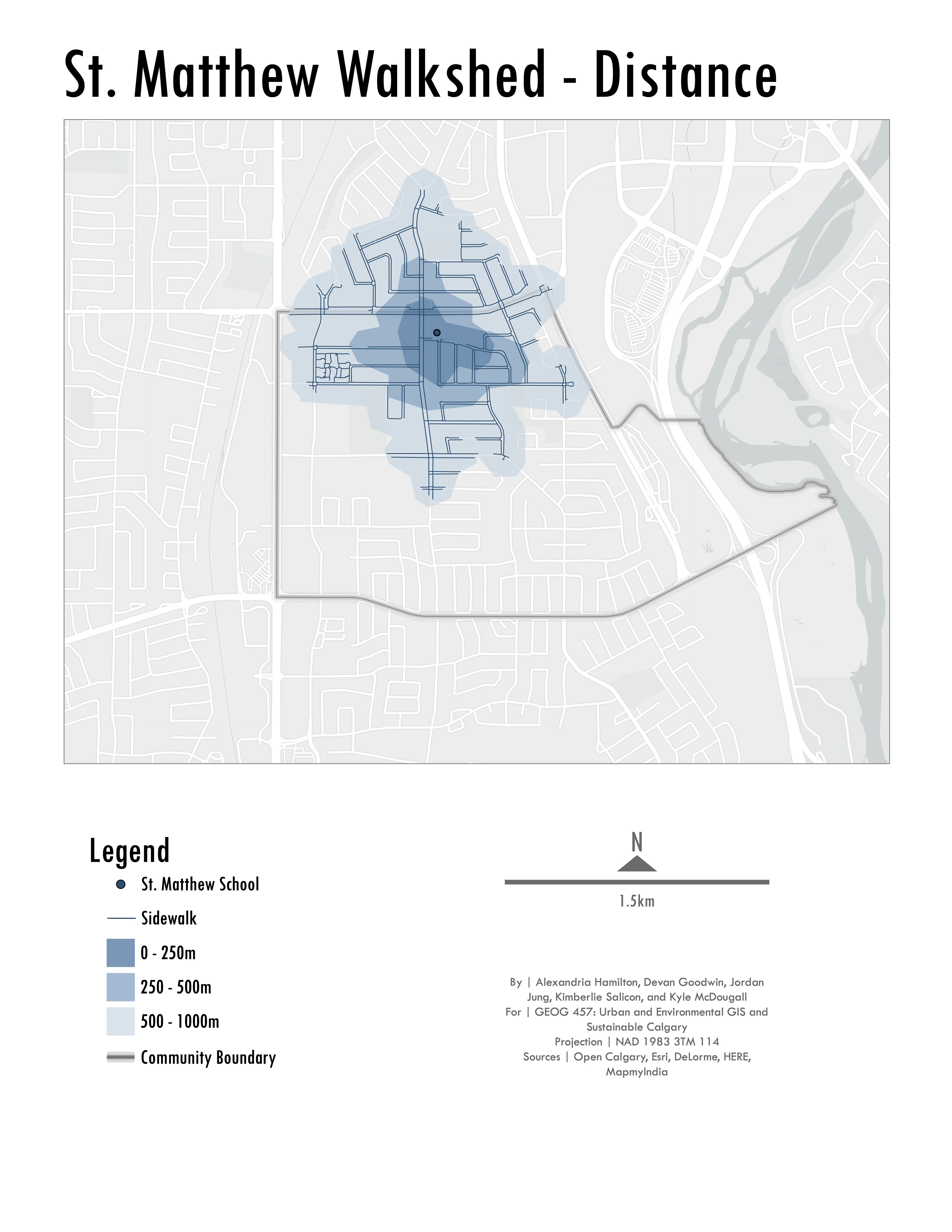
This project was collaborative, and my main contributions include the network analyses to determine walking areas around public transit stops within and surrounding the community of Acadia, as well as the cartographic design of all of the maps included in the report and some report design.
Several of the 17 maps produced for the project are included below, and the full report can be found on Sustainable Calgary's website by following the link below.